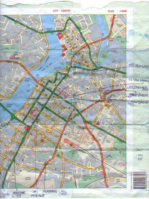
To trace the fire we divided the town centre into two zones:
North and south of Roches Street and patrolled our beats for the
next twelve days.
Tracker one north of Roches Street:
Set off from Portley’s across the river.
South-east down Broad Street - pass shops and a bar or two – an
alleyway on the left goes behind to the terraces on Curry Lane.
For some residential ground Clare Street has the newer estate, then
double back to St. John’s Street so The Launch comes into view.
Slide down Cabbage Market round the back taking in yards and houses,
then make a loop by the cemetery - The Holy Ground is on the corner.
Follow the church spire, pass opposite the Square Bar and those
offices are used in the daytime – walk alongside the new apartments,
direction of Nancy Blake’s heading into town.
Tracker two in the south:
Step towards the river from the Wolf Tone for pubs and businesses on
Henry Street, or else east past the barracks and into a high-density
residential area.
On Lord Edward Street is Slattery’s - cross over for the estate along
Hyde Road.
Or west via the People’s Park and four-storey townhouses - W.J. South’s
is up ahead. Wind round the streets and conduits past the local press,
into the White House on Glentworth Street, and afterwards north into
the main shopping district.